Overview
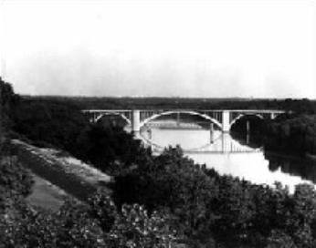
The Franklin Avenue Bridge was the longest concrete arch in the world at the time of its construction.
- Location: Franklin Avenue at the Mississippi River
- Neighborhood: Seward, Prospect Park
| 1923 | 2006 |
|---|---|

|

|
The Franklin Avenue Bridge was the longest concrete arch in the world at the time of its construction.
| 1923 | 2006 |
|---|---|

|

|
The Franklin Avenue Bridge was the longest concrete arch in the world at the time of its construction.
Prominent Norwegian engineers Frederick William Cappelen and Kristoffer Olsen Oustad designed the bridge. The pair also designed the Cedar Avenue (now 10th Avenue) Bridge together in 1914-1918. Each served as the city's municipal bridge engineer during their careers. The Franklin Avenue Bridge was built between 1919 and 1923. It connects two Minneapolis neighborhoods over the Mississippi River. It is made out of steel-reinforced concrete. The bridge has a flat roadway deck supported by a 435-foot arch and square spandrel columns. The concrete finish is plain without molding or ornament. The railing is painted beige and features square columns and elongated diamond cutouts. It is 1,054 feet long and has a vertical clearance of 88 feet.
Engineers from all over the world have come to the city to study the bridge. Cappelen died during the construction. The bridge is known as the Cappelen Memorial Bridge to honor his life and career.
Surface repairs have been made to the bridge throughout its lifespan. The structure has remained intact. It currently has two vehicular travel lanes, off-street bike lanes, and pedestrian paths. It connects East and West River Parkways on the Grand Rounds National Scenic Byway.
Community Planning & Economic Development (CPED)
Phone
Address
Public Service Building
505 Fourth Ave. S., Room 320
Minneapolis, MN 55415