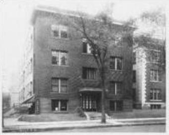
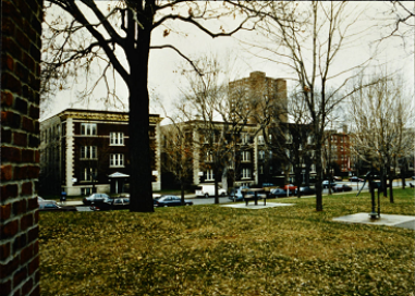
The Stevens Square Historic District includes a high density of brick apartment buildings, mostly from the 1910s and 1920s. The buildings surround a park called Stevens Square.
This area had been settled by Colonel John Harrington Stevens in 1849. Stevens was a veteran of the Mexican-American War. The U.S. government gave him permission to acquire this land. It was mostly farmland until the 1880s. Some single-family houses were built, including one for Stevens himself. A few houses still stand from this era. In 1896, the Stevens House was moved to its current location in Minnehaha Regional Park. In 1907, Stevens Square was created as a park and given to the City of Minneapolis.
Many new residents arrived in Minneapolis starting in the 1880s. They were drawn to growing job opportunities downtown. By the early 1900s, the streetcar system had expanded, making it easier to live outside of downtown. The city lacked affordable housing to meet the demand. So developers built three-story apartment buildings in this area. Many of the district’s buildings were constructed in this decade. By 1919, it was the highest-density residential area in the city. Abbott Hospital was also built nearby.
Development continued until 1950, although at a slower pace than before. There have not been many significant changes in this area. Abbott Hospital was converted into apartments in 2013.
Well-known architects and builders designed the apartment buildings. Most have brown brick walls with stone, terracotta, or tile accents. Many have characteristics of the Renaissance Revival style. For example, cornices project from the rooflines. Some buildings have stone quoins on the corners. A few buildings are Collegiate Gothic or Mediterranean Revival in style. Most buildings are rectangular. A few have a U shape or E shape, which creates courtyards for residents.


