Minnehaha Historic District

Read about the history and designation of the Minnehaha Historic District.

Overview

The Minnehaha Historic District includes one of Minneapolis’ oldest and most popular regional parks. The Minnehaha Regional Park has over 167 acres of natural and recreational areas. 

  • Location: Generally bounded by Nawadaha Boulevard, 39th Avenue South, 49th Street, Hiawatha Avenue, Minnehaha Avenue, Minnehaha Creek and the Mississippi River
  • Neighborhood: Hiawatha

Map

See the map for this district

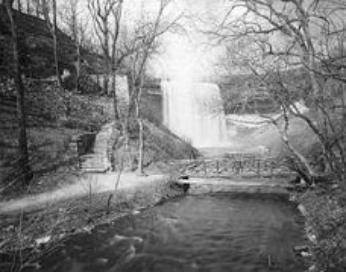
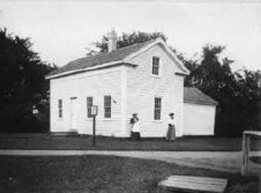
1895 1905
Minnehaha Historic District 189
Minnehaha Historic District 1905

Details

Architecture

  • Architectural Style: Not applicable
  • Architect: Not applicable

Use

  • Historic use: Recreational
  • Current use: Recreational

Construction

  • Construction date: Various
  • Contractor: Various

Significance

  • Area(s) of Significance: Architecture, Commerce, Community Planning and Development, Conservation, Literature, Transportation
  • Period of significance: Undefined
  • Date of local designation: 1986
  • Designation: Exterior
  • Date of National Register designation: 1969

Historic profile

The Minnehaha Historic District includes one of Minneapolis’ oldest and most popular regional parks. The Minnehaha Regional Park has over 167 acres of natural and recreational areas. Here, Minnehaha Creek used to empty into the Mississippi River. At its heart is the iconic Minnehaha Falls. There are also a few historic buildings.

Native Americans have lived in what is now Minnesota since time immemorial. Lieutenant Zebulon Pike established the first military reservation in the area in 1805. In the mid-1800s, tourists visited on steamboat tours of the river. Generations of people have been fascinated by the waterfall. Artists and poets have popularized it. The name Minnehaha comes from words in the Dakota language that mean waterfall. Ard Godfrey built a mill below the falls.

In 1883, landscape architect Horace W.S. Cleveland sketched the master plan for the Grand Rounds in Minneapolis. This is a connected system of parks and roadways along the city’s water features. Cleveland wanted to emphasize the natural beauty of the riverbanks and lakes. This area was part of the plan but it was outside the city limits at the time. In 1889, the park board accepted the land from the State of Minnesota to create the park.

The park has an 1870s Victorian train depot that was built by the Minnesota Central Railway. It is called the Minnehaha Princess Station. The Greek Revival-style Stevens House was moved here in 1896. It is one of the city’s oldest houses, originally built near St. Anthony Falls. The Georgian Revival-style Longfellow House is also here, built in 1906 by Robert F. Jones. It is a replica of Henry Wadsworth Longfellow House in Cambridge, Massachusetts.
Credits

Photo credit

  • 1895 photo of Minnehaha Falls: Courtesy of the Minnesota Historical Society
  • 1905 photo of the Stevens House: Courtesy of the Minnesota Historical Society

Works cited

  • John Grossman, "National Register of Historic Places Inventory – Nomination Form: Minnehaha State Park," October 1969
  • "The Minnehaha Park Restoration Plan," Summer 1992
  • Minneapolis Park and Recreation Board

Contact us

Heritage Preservation

Community Planning & Economic Development (CPED)

Phone

612-673-3000

Address

Public Service Building
505 Fourth Ave. S., Room 320
Minneapolis, MN 55415